Thirty five times around the sun. Ten revolutions ago I ran my first 5k race. Five revolutions ago was my first marathon. Two, my first bike tour. I yearn for more. To travel further, push harder, see more, do more. Thirty Five was to be the Great Divide year. Life got in the way.
Make the most of what you have. I didn't settle for this tour. Rather, I took advantage of the opportunity to explore my own backyard. We need to do this more often. Every time we look, we find something new.
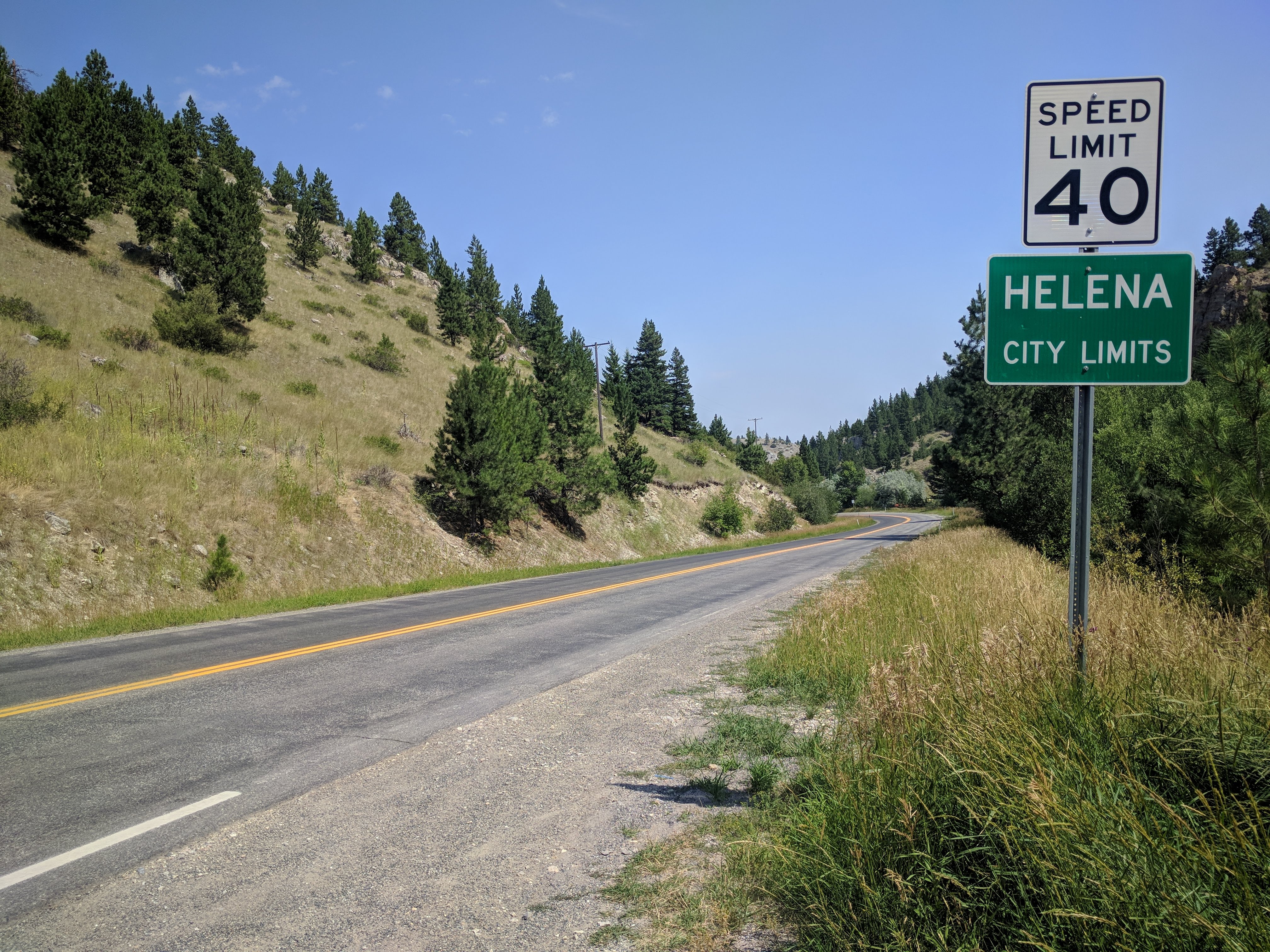
Now entering Helena.
Old Woman Grave
My first tour leaving from my front door made preparation a breeze. I was able to organize, pack, and load up the bike the weekend before I left. So, when Monday rolled around I could enjoy the last morning I would have with my kids for the next two weeks. They would be leaving for their annual stay with the Grandparents that day, too, so we decided to meet for a quick breakfast out at Four Corners. I left the door a little after eight and we sat down to breakfast at nine, a tenth of my mileage already done for the day.
8 miles (8 total)
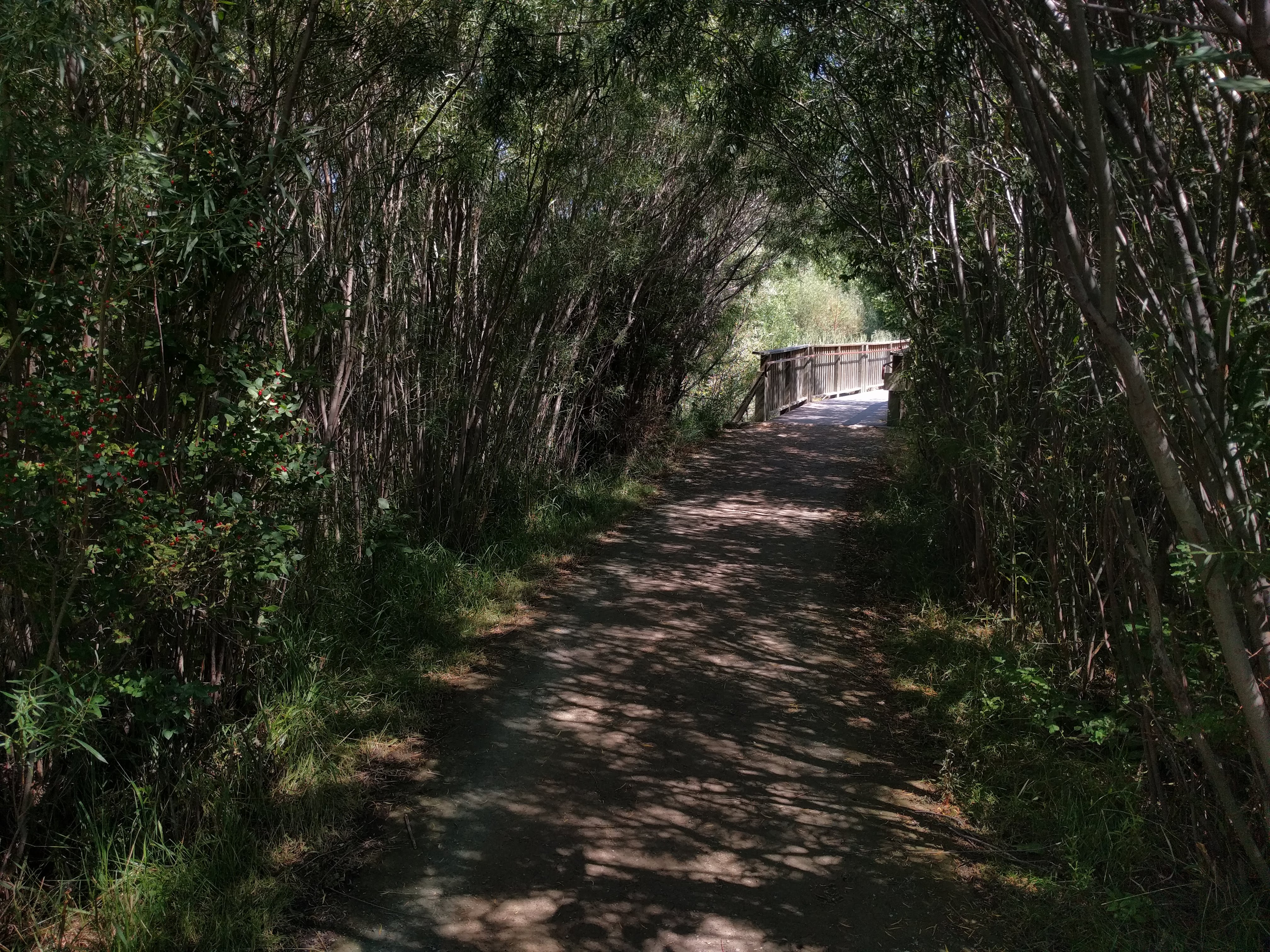
There are plenty of route options between Four Corners and Three Forks. This was the easy part. I opted for a paved potato tour through Churchill to Manhattan, then a short jaunt up the frontage road until I hit the Three Forks town trails. Of all the small Montana towns, you wouldn't expect Three Forks to have the walking and biking infrastructure that it does. Miles of paved paths extend in and around the town, including at least one pedestrian bridge over the Madison River (that I'm aware of). Instead of following the trails through town, I took the unique Old Town Road. This partial dirt road crosses the Jefferson River on two old truss bridges and meets up with Highway 287 a couple miles north of I-90.
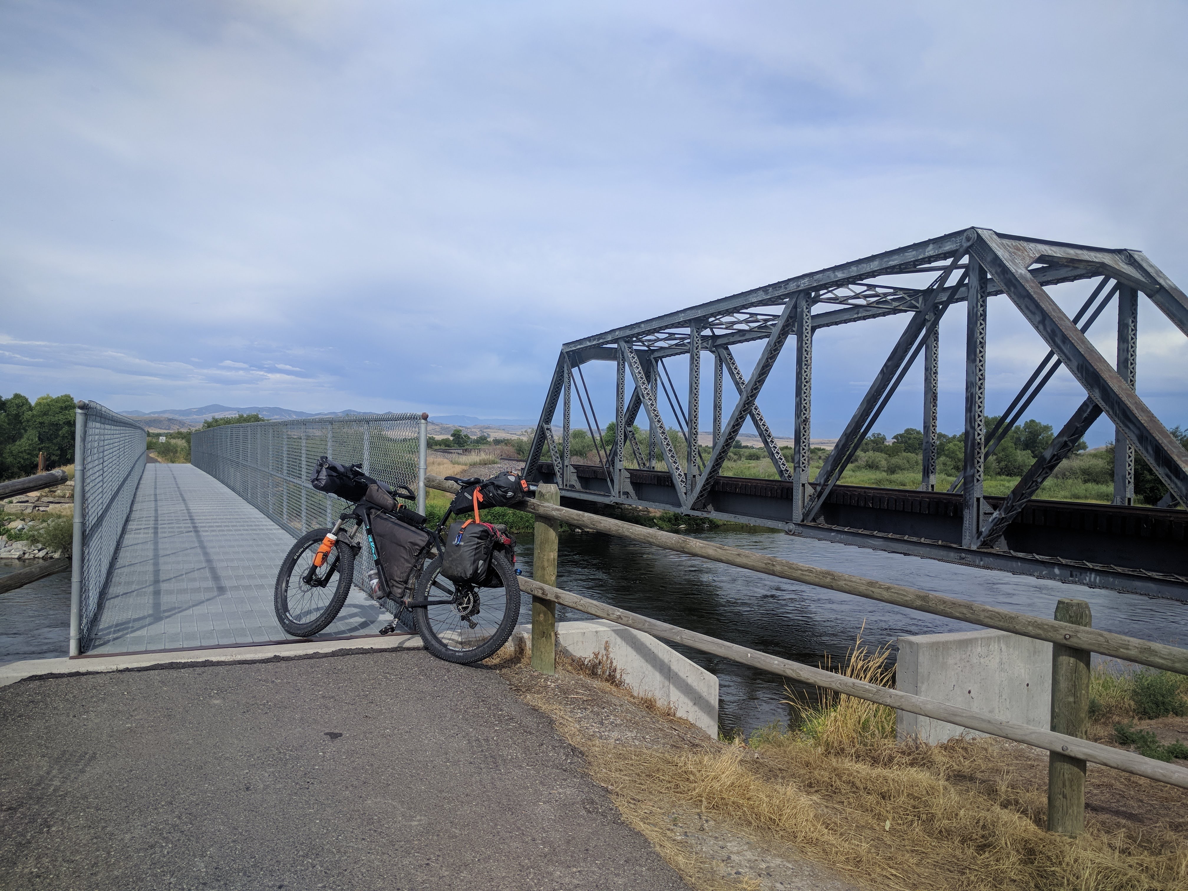
Crossing the Madison.
As every Montanan knows, the quickest way to get to Helena from Bozeman by car is to head West on I-90 to Three Forks, then head North on Highway 287. Every Montanan also knows that Highway 287 is the absolute worst road in the history of roads to be riding a bike on. Even with recent improvements, the majority of two lane sections between Three Forks and Townsend remain shoulderless. Combined with bumper to bumper, 75 mile per hour traffic makes for a cyclists death sentence.
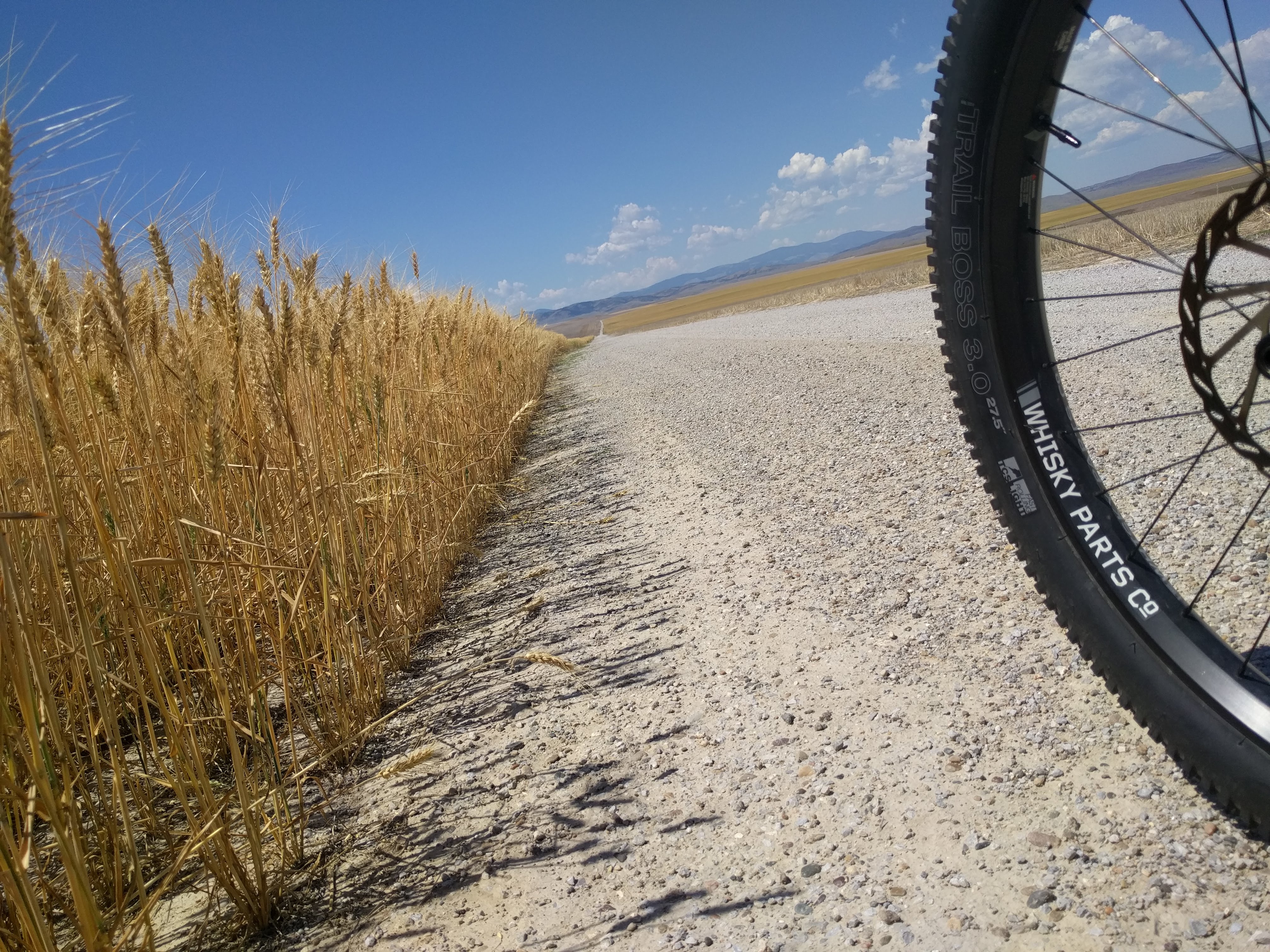
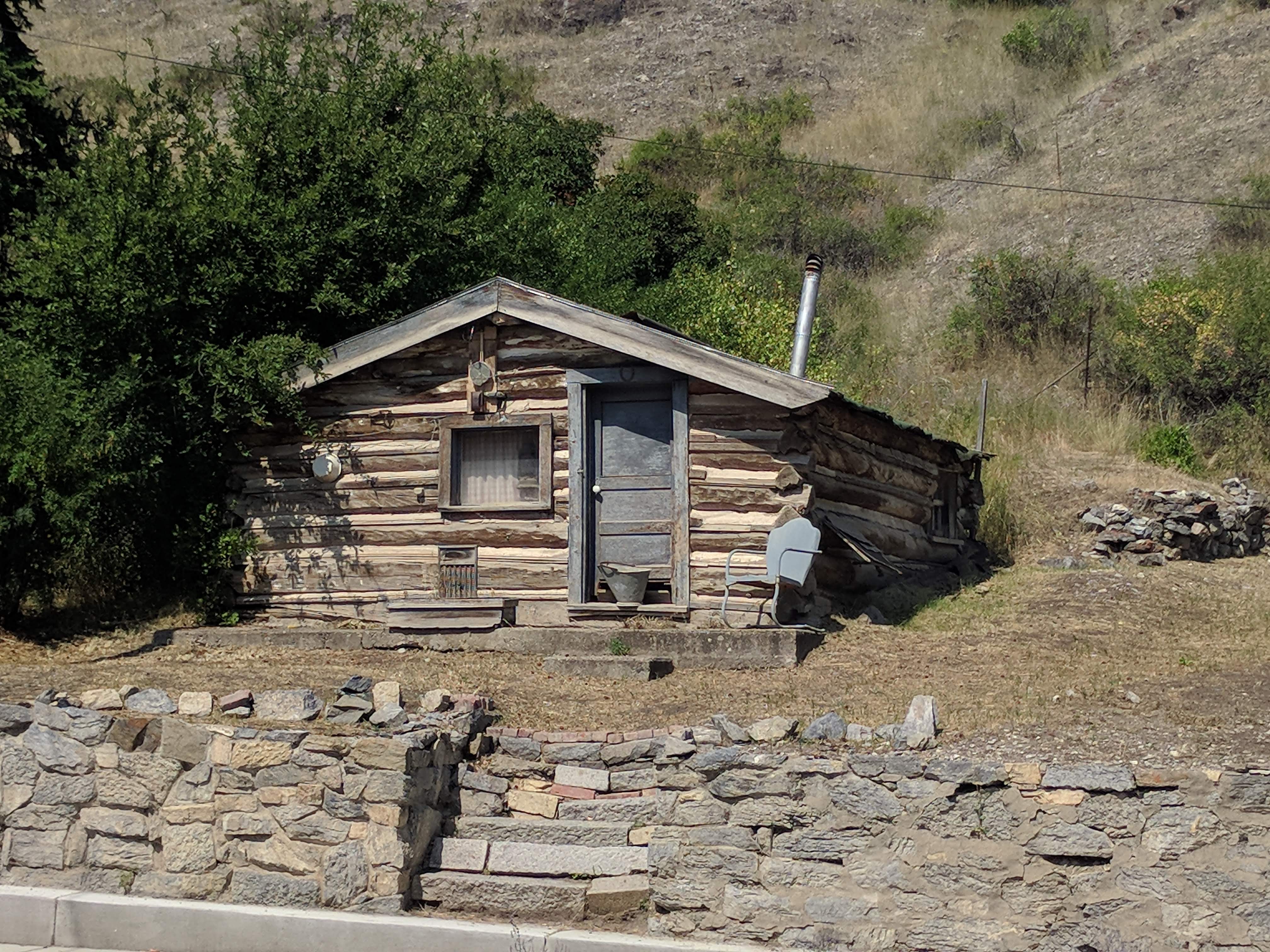
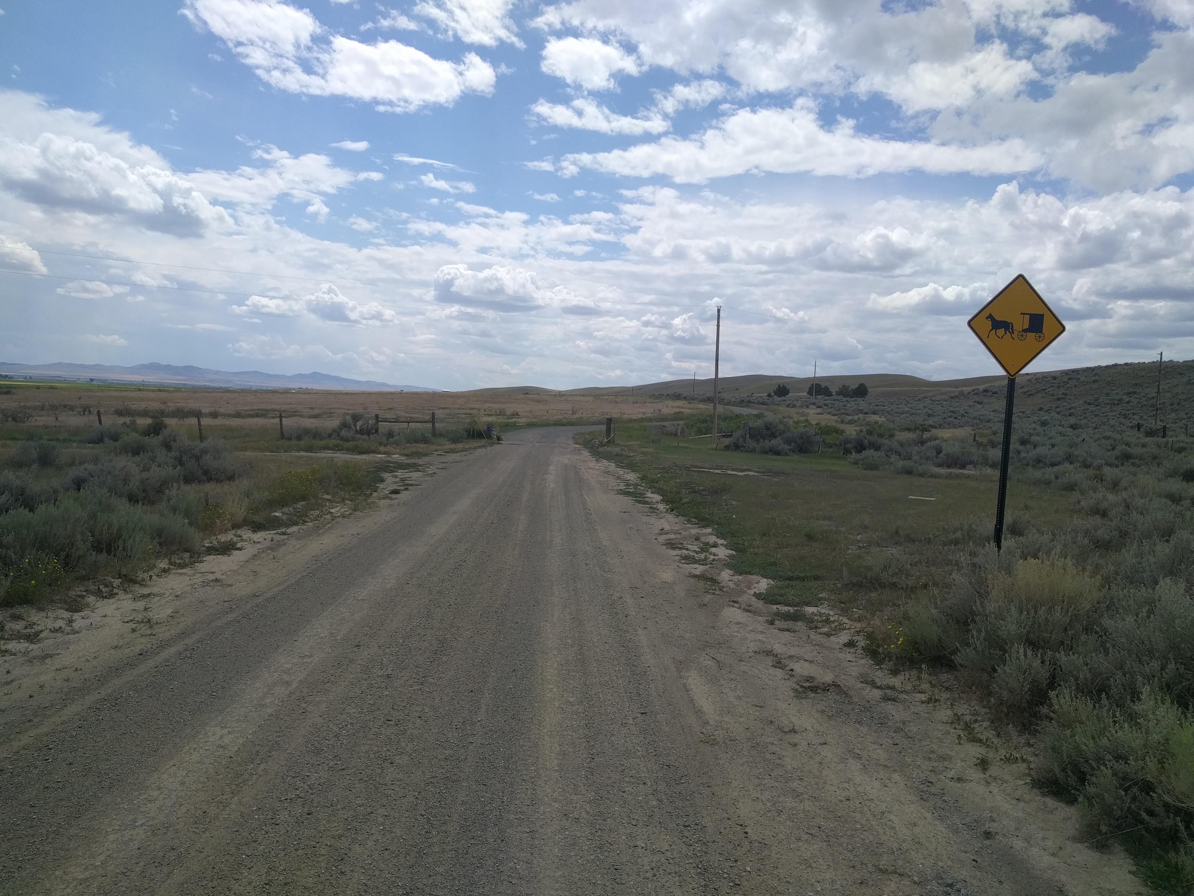
I could have easily planned a true bikepacking route through the Elkhorn mountains and bypassed Townsend entirely. But, that would have been a hundred mile stretch without services and would have surely added an extra day or two to the ride. I wanted to have as much time as possible in Helena, so I opted for an easier route that would allow me to camp the first night near Townsend. There are plenty of dirt (and even some paved) roads that meander through the wheat fields west of 287. My good friend Tim suggested I take a little known road by the name of Old Woman Grave Road. This path would also take me close enough to the town of Radersburg that I could make a short detour and do a little exploring.
Timeless
One word of caution to anyone who may follow my GPS tracks; there are no "Private Property" or "No Trespassing" signs until the opposite ends of the road. I had made my way through ten miles of what my map claimed to be unmaintained public roads before I ran into a gate. The problem was the gate was meant to keep people off of the road I was already on! Oh well, no harm no foul. Hop the (locked) gate and continue on to the quaint town of Radersburg and Old Woman Grave Road, which lives up to its name. There's a gravestone halfway down the northern end that marks the burial of Charity Dillon over 150 years ago.
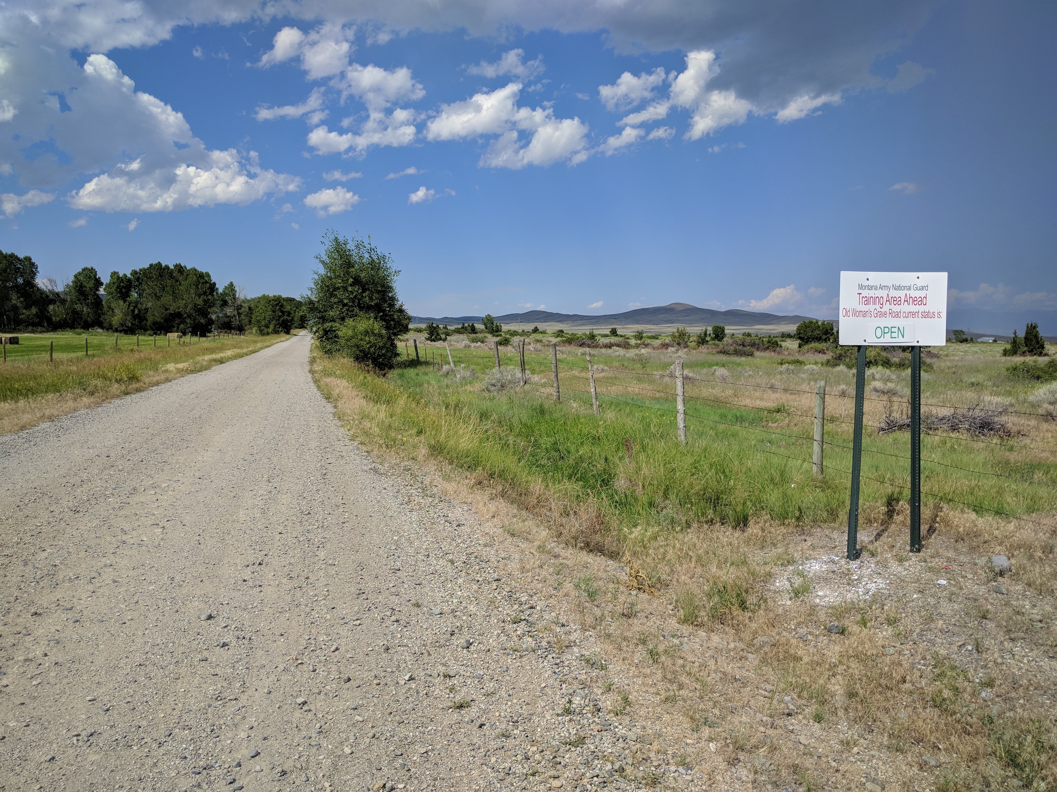
Old Woman Grave Road travels through a National Guard training facility.
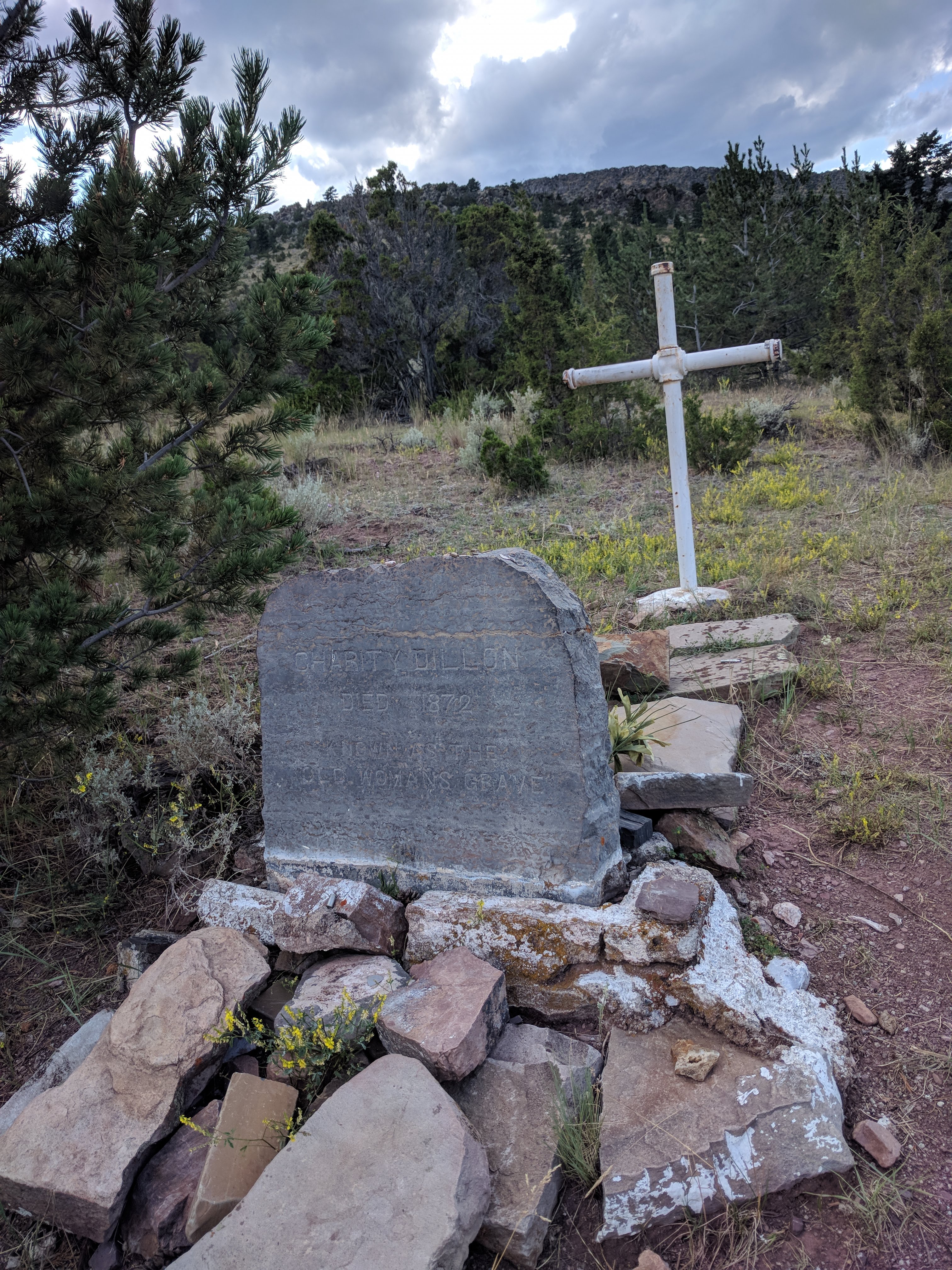
True to its name, there's an old woman's grave near the top.
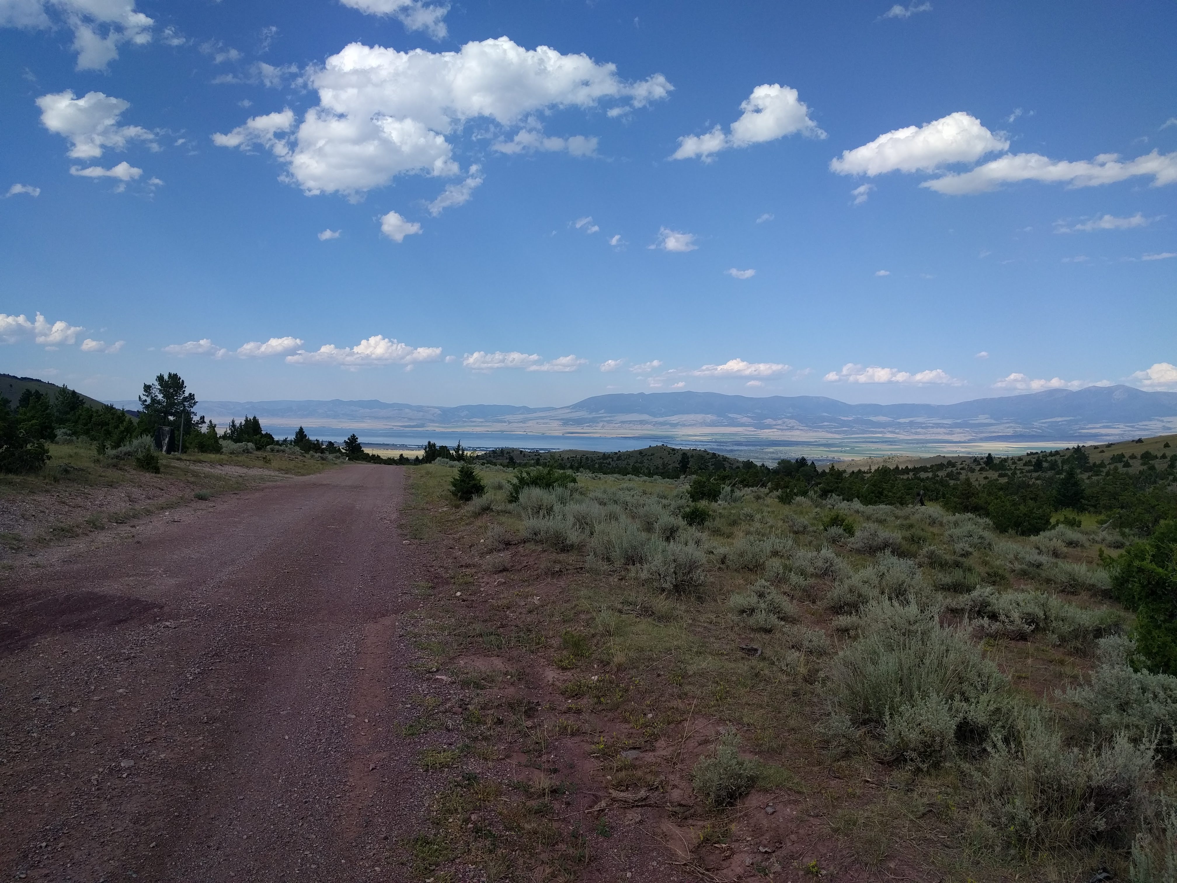
... and a nice view of the valley.
I pulled into Indian Creek campground, my spot for the night, and rode into Townsend for a beer at the newly opened Canyon Ferry Brewery [brewery 1].
74 miles (82 total)
Canyon Ferry
I hadn't eaten anything besides junk since breakfast the day before, so I took the recommendation of some locals and headed into The Mint as soon as the sun came up. There are exactly 137 establishments in Montana named The Mint. Some are decent, some are dives, some are both. This one was a quintessential diner with breakfast burritos the size of a small baby. Average quality, but more than enough quantity for the cost. This was the only breakfast burrito that I have not been able to finish, and it was only $11.
I would make it the rest of the way into Helena the second day, but it would be entirely on paved roads. Highway 287 is much nicer between Townsend and Helena with a five foot shoulder the entire way, but I opted for less traffic on highway 284, skirting the northern side of the reservoir and crossing the dam at Canyon Ferry. I could count the number of cars on one hand until I reached the town of Canyon Ferry and the dam, at which point traffic increased slightly. I enjoyed this route. The first twenty miles were relatively flat and the panoramic views were fantastic. After that came several miles of rolling bluffs as the road engaged upon the water's edge.
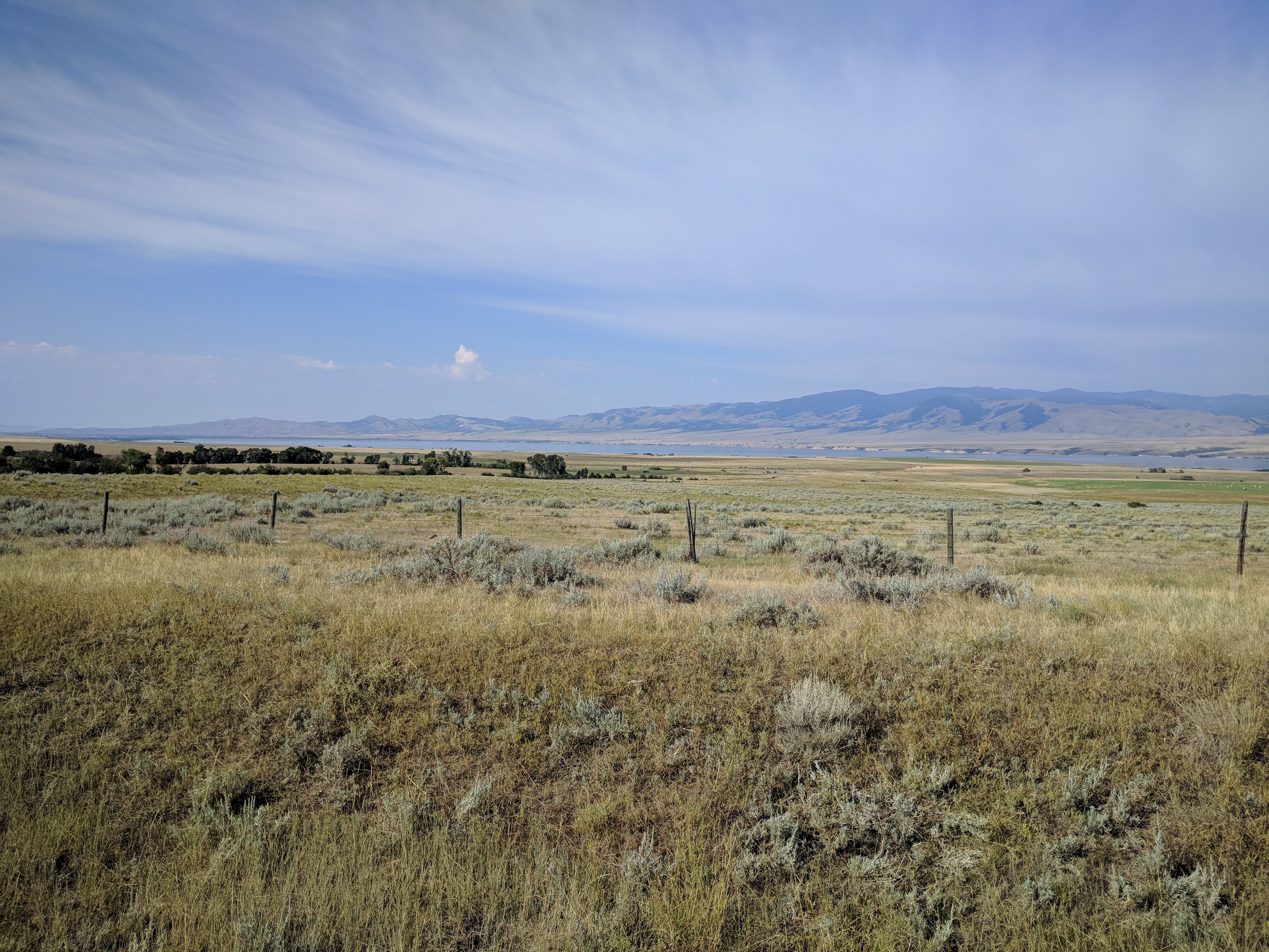
This side of the reservoir is quieter.
This could almost be anywhere in Montana.
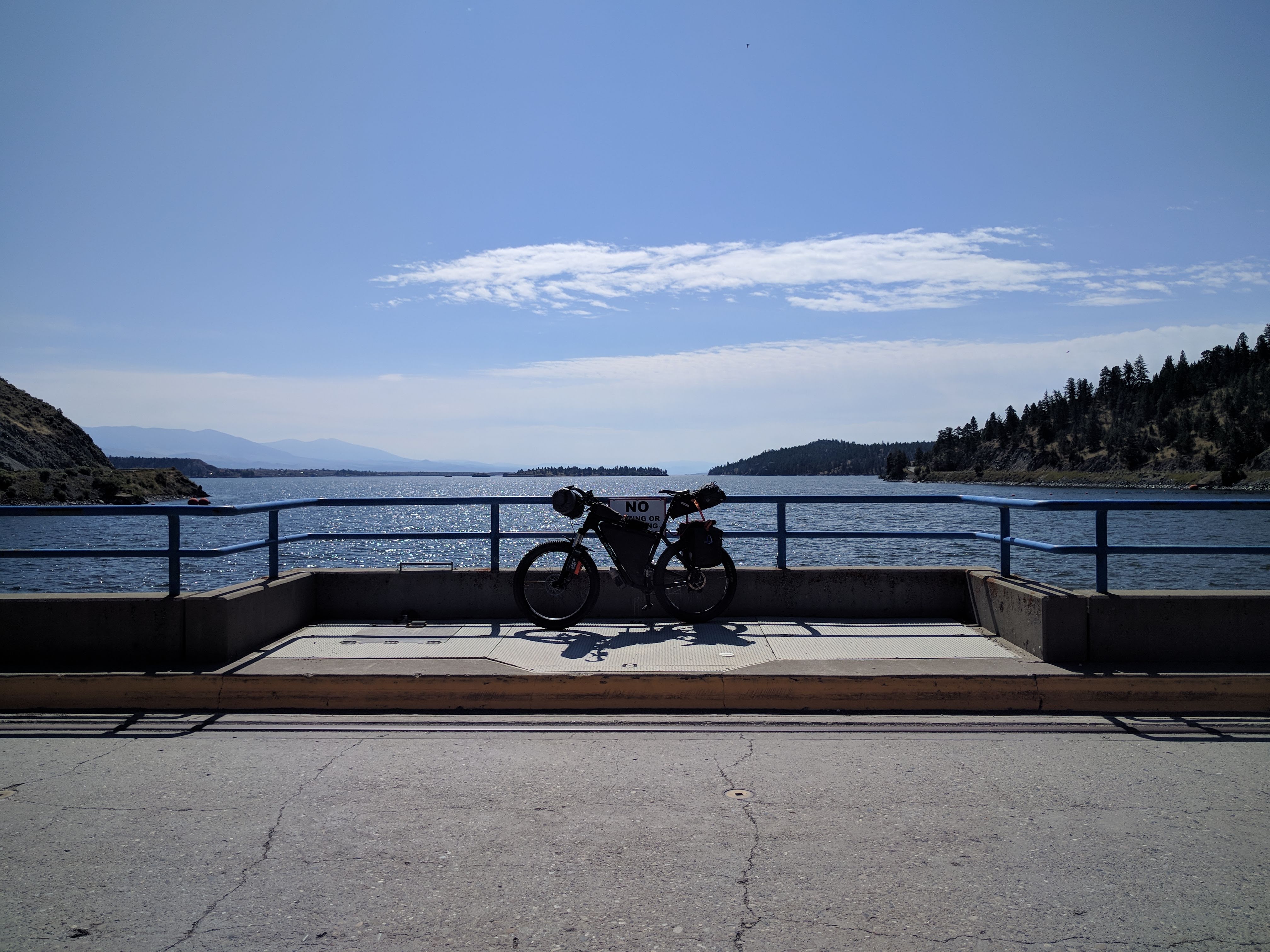
Dam
But, the heat of the day was catching up with me by the time I had crossed the dam. The temperature was topping ninety degrees and it wasn't even noon yet. So, I pulled over at a random restaurant overlooking the lake for a drink, a bite, and some shade.
37 miles (119 total)
An August afternoon in the middle of the Montana Outback. Twenty treeless miles, every one of which slightly more uphill than the last. The city of Helena in view, but never seeming to get any closer. Tires melting through the tar on the street, slowing the bike down to little more than a crawl. It didn't take any more than a couple hours to reach town from the dam, but it felt like an eternity.
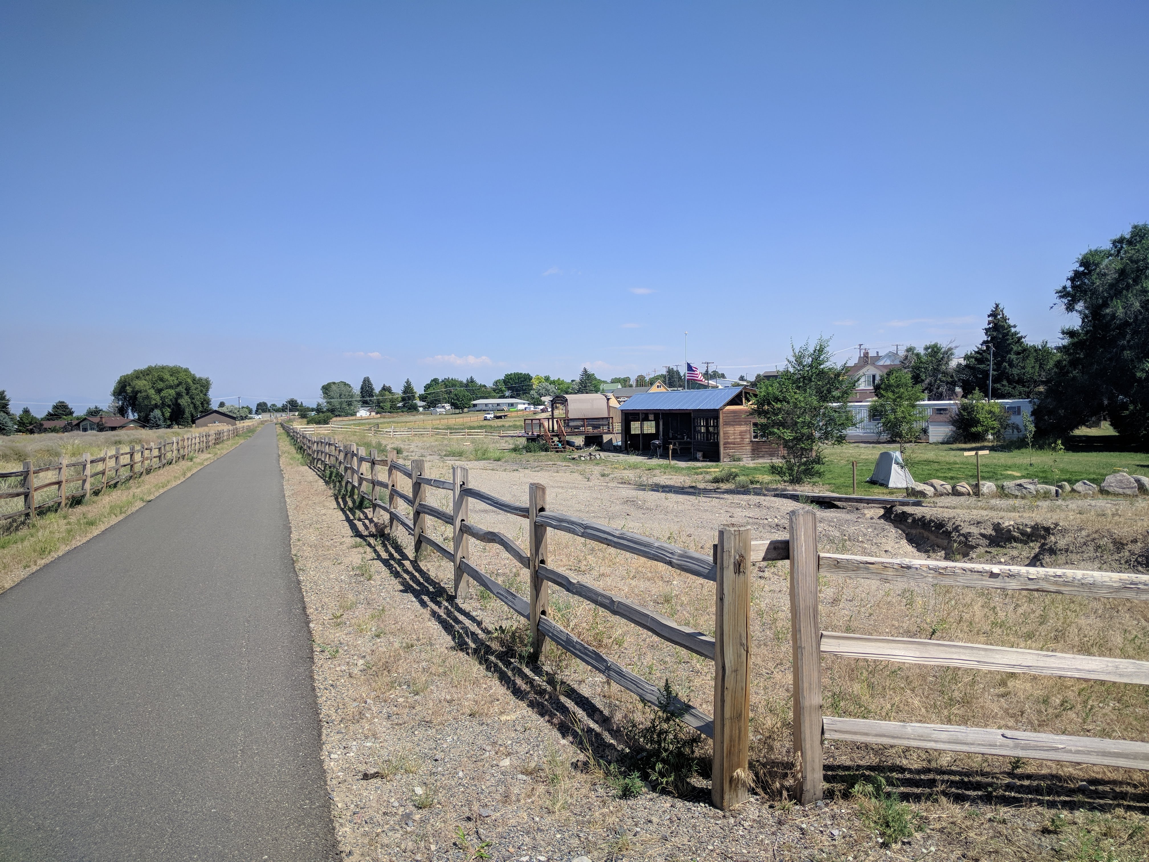
I was staying at a newly constructed tent site called MTBCity. Helena is a major stopping point on the Continental Divide Mountain Biking Route and MTBCity exists to serve through-riders a more luxurious night's rest than they're used to. With a handful of tent sites on manicured grass, a warm shower, indoor bathroom, outdoor cooking area and bike storage, there's no reason not to fork over the $10 to spend a night there. There's even an optional bedroom rental if you're into the cushy lifestyle. The location is also unbeatable. Helena's Centennial Trail runs right next to it, providing easy access to the rest of the town, and the mountain trails are just a stone's throw away.
My little tent under the sapling.
When I arrived at MTBCity, there were five other guests. Four were attempting the Tour Divide and would leave later that evening when the heat of the day dissipated. The other was a tourist and would be on his way to Kalispell by the next morning. It was nice to chat with the other guests, but in a way I was relieved. With so many people the quarters would be too cramped for my liking. The remaining two nights of my stay I would be the only tent guest at MTBCity.
That evening I had a nice soak and an amazing meal at Broadwater Hot Springs right down the street.
23 miles (142 total)
Mount Helena
I had always heard great things about the trails around Helena, specifically those in the South Hills. They're typically popular for those in my neck of the woods as early season rides, since they tend to dry out much quicker than our local trails do. But, parenting conflicts make it difficult to get away in the Spring, so I can make-do in the Summer. This morning I would be exploring the Ridge trails by following Grizzly Gulch in the Southwest. But, not before a morning coffee break in historic downtown. If you haven't tried FireTower Coffee yet, you're missing out.
This Wednesday morning began much cooler than the previous day, overcast with a few light sprinkles to make for a much easier climb than it could have been otherwise. Another rider passes me as I'm gawking like a tourist at the historic structures in the Gulch. He looks like he knows where he's going. Must be a local, so I step into gear to catch up with him.
"Can I bother you with a few questions?"
Yes, it turns out I can ride all the way up Grizzly Gulch and arrive at the main trailhead for the Ridge. But, why would I do a silly thing like ride on the washboards when I could ride on perfectly good singletrack? Tom turned out to be an awesome guy who let me tag along with him the entire morning. He made sure to stop occasionally and point out landmarks and other points of interest as we made our way up (and down) Wakina Sky trail until we met back up with Grizzly Gulch. Instead of making my way up Grizzly Gulch the rest of the way on my own, I hung around with Tom as we continued up the Mini Ridge trail and back down the main Ridge trail to Diretissima and Swaney trails, at which point we met up with city streets.
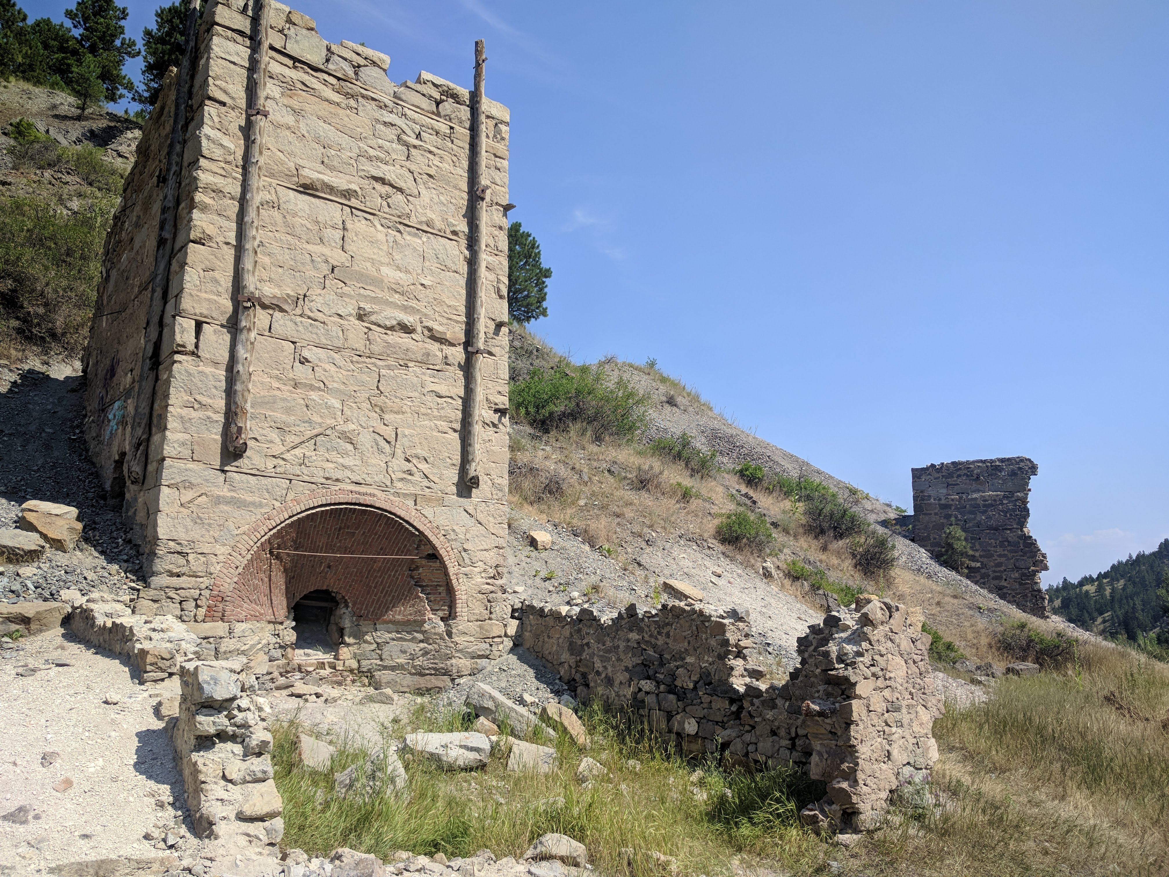
Old lime kilns lined Grizzly Gulch.
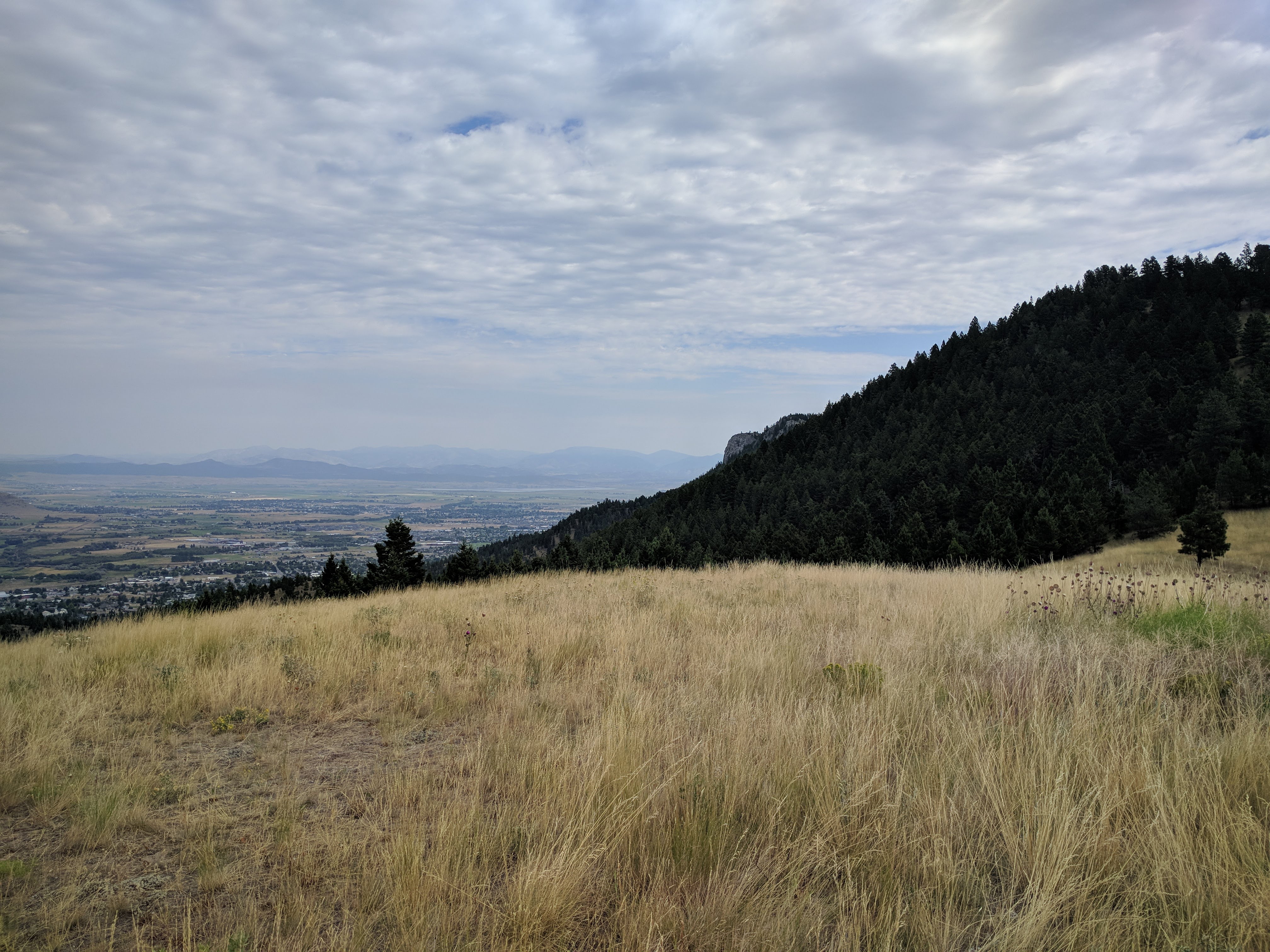
View of the city and the top of Mount Helena.

There are two Park City, Montanas.
It was far more than I could have asked from a complete stranger to let me ride with and show me the lay of the land. I am indebted to Tom, and as we parted ways we exchanged contact information. When he gets himself to Bozeman, I'll be sure to return the favor.
15 miles (157 total)
After a needed shower back at MTBCity, I took a quick walk over to the adjacent Montana Wild facility. This State Park is home to a reclaimed ore processing waste site, now pond and wildlife refuge. It also houses a small wildlife information and bear rehabilitation center. But, unfortunately they don't let you view the bears. The place was interesting, but I didn't spend much time there. My sole purpose for going was to return a driver's license and credit card to a local individual. I had found them laying on the road on my ride into town the day before.
Trails in the State Park by Montana Wild.
I hopped on my bike after Montana Wild to wander downtown and view more historic structures. The city of Helena has an app available free to download. It gives locations and describes many of the local landmarks. While downtown, I made an appearance at two local breweries; Ten Mile Creek [brewery 2] and Blackfoot River [brewery 3] and a neat little Mexican restaurant in the historic buildings known as Reeder's Alley.
Hundred and fifty year old cabins still in use today.
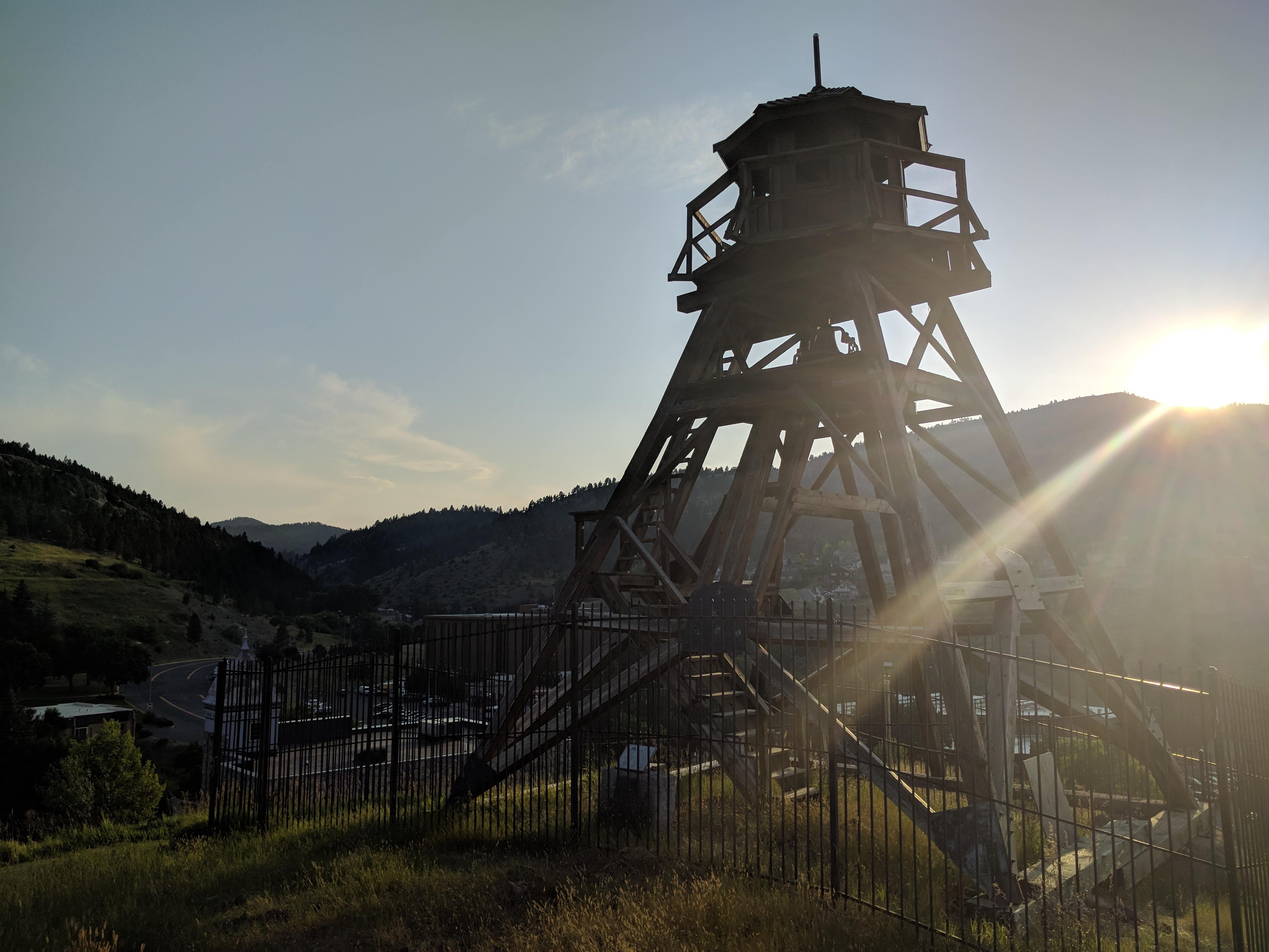
The old firetower in the middle of downtown.
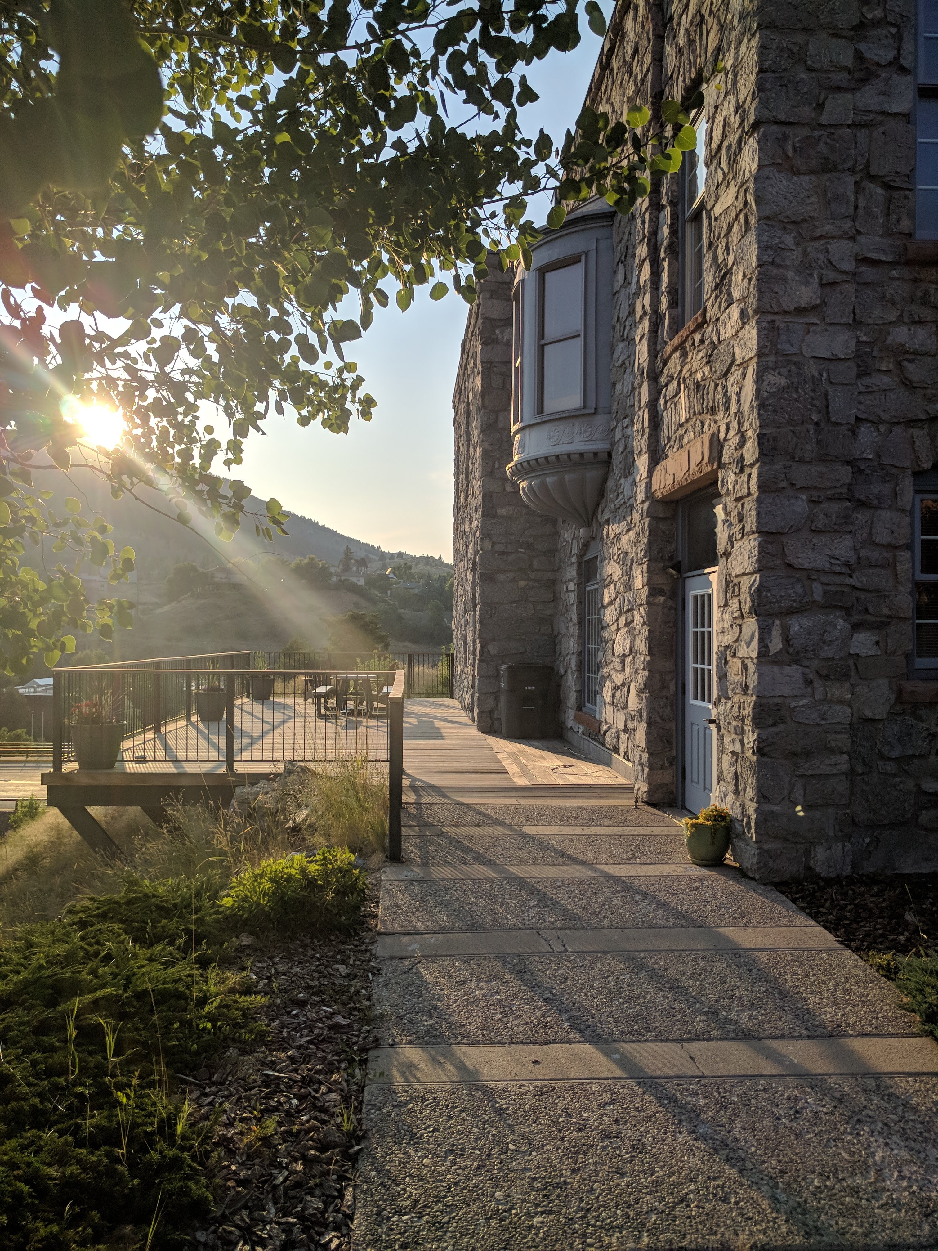
Old stone mansion by the firetower.
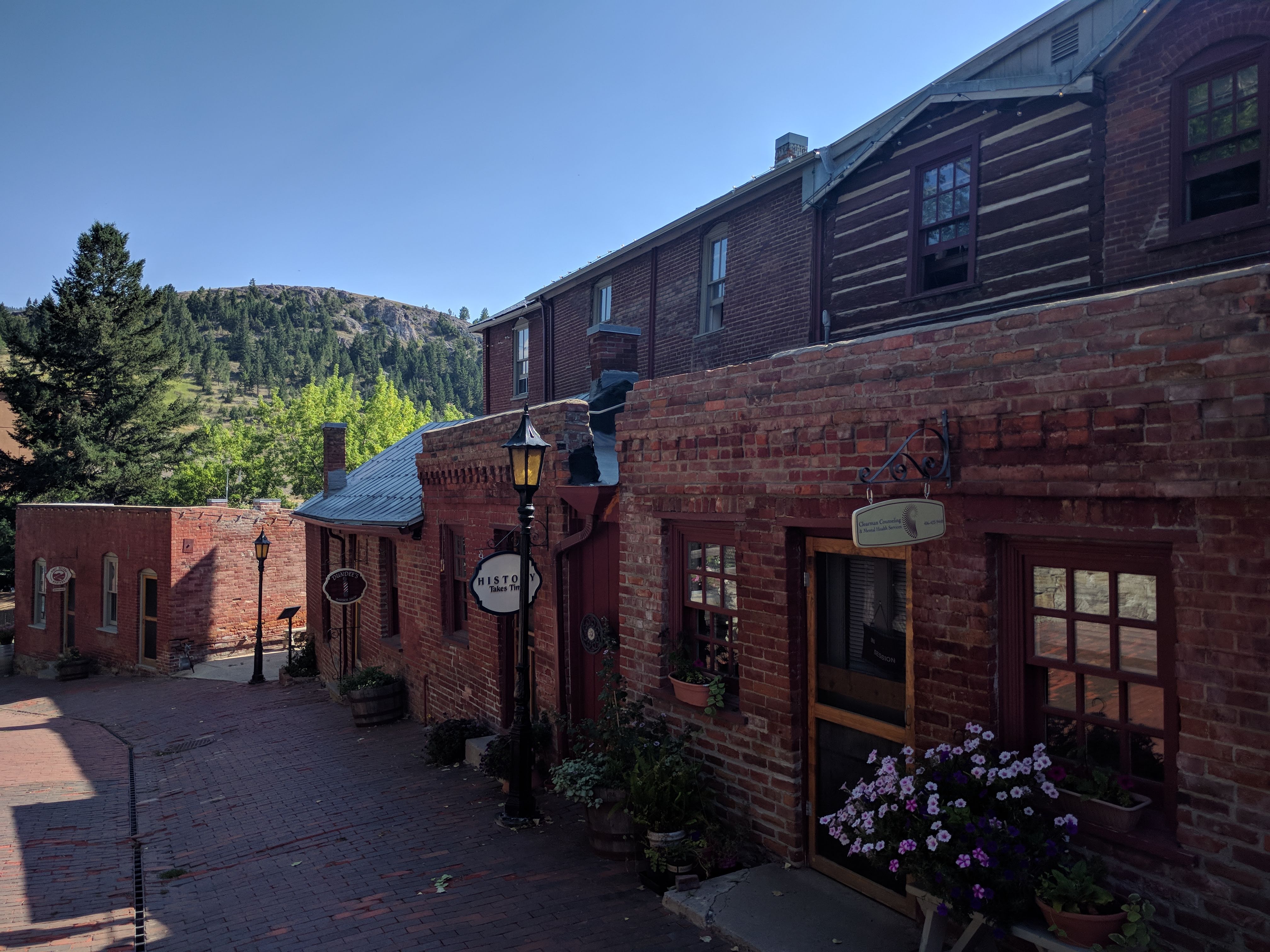
Reeder's Alley
10 miles (167 total)
Mount Ascension
My stomach was not happy at me this morning. I don't blame it after the beers and Mexican the night before. It was already pushing 70F by the time I left the campground, I needed sustenance for the ride ahead of me. We had learned about Steve's Cafe from my cousin who had lived in Helena several years ago, and it's still one of the best diners in town. The [homemade] sausage sampler platter, two over-easy eggs, browns and toast went down much easier than expected. I must have just been hungry.
It was less than a half mile south of Steve's where I met up with the trails I would be riding today. A kick-your-butt thousand foot climb over two short miles up the 2006 Trail to the top of Mount Ascension. The view at the top and descent down Entertainment Trail were worth the pain. A wrong turn off Entertainment Trail sent me down the Aftershock Trail, so instead of returning the same way I decided to get back via the Archery Range Trail. No complaints here, these trails are in superb condition and a few extra miles was welcomed.
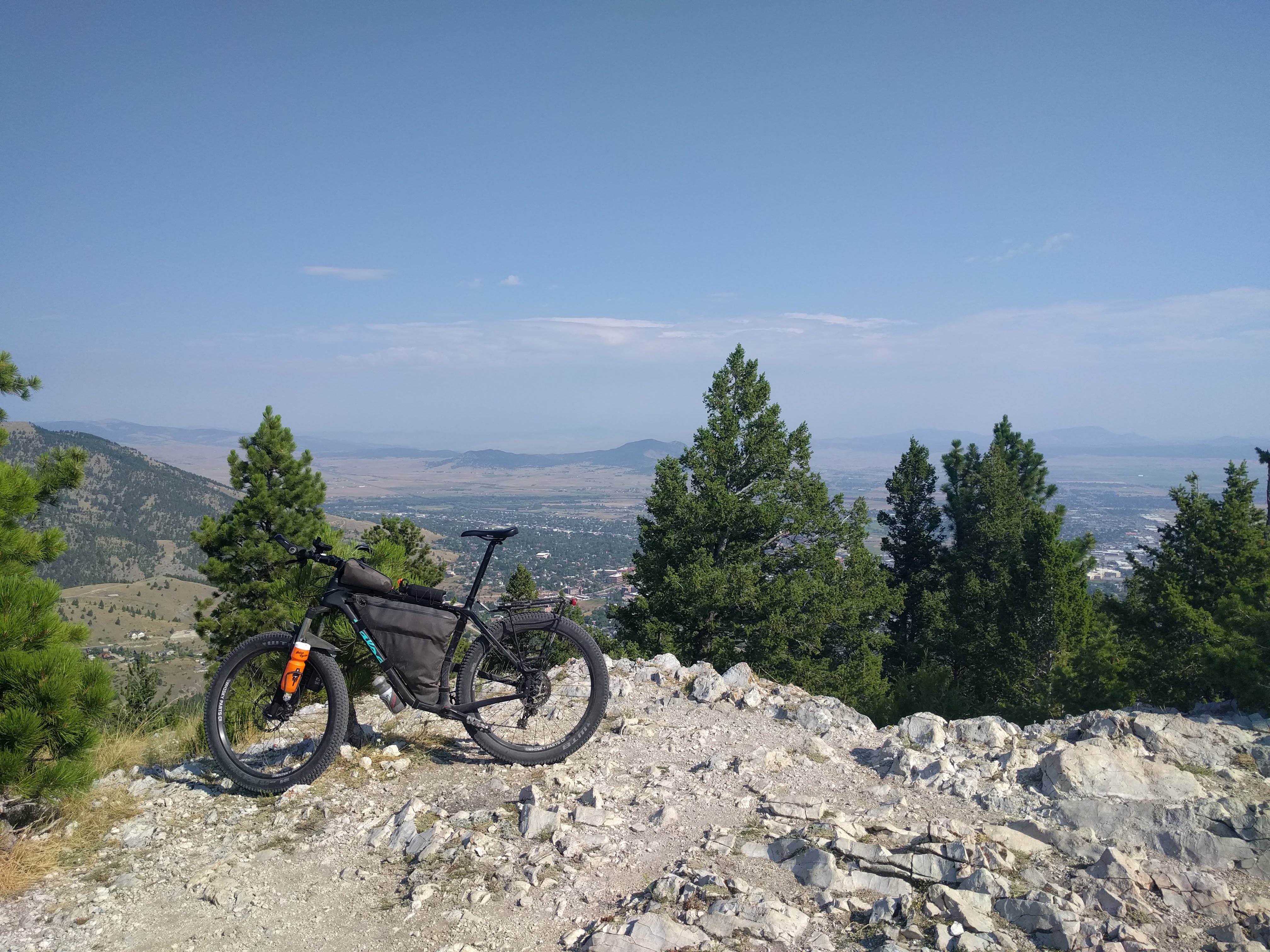
Mount Ascension
The end of the Archery Range Trail brought me to Davis Gulch road, the other side of which was a bike skills park. This was something I wish Bozeman had; a shorter skills park, made for adults (not a pump track), and easy enough that you don't feel like you're going to seriously hurt yourself. I only went through the skills park once, but I regret that decision. It was one of the more enjoyable experiences of my time in Helena.
From the skills park, it was an easy climb up over Rodney Ridge Trail to the Waterline Trail and on to Oro Fino Gulch Drive back to town for an espresso milkshake at Big Dipper Ice Cream. Ice cream is best enjoyed on ninety degree days like today.
19 miles (186 total)
A nap and a shower later, I was off to spend my last evening in Helena visiting a couple more breweries; Snow Hop [brewery 4] and Crooked Furrow [brewery 5]. A last hurrah also calls for a nice meal at On Broadway. Fantastic live jazz music, cocktails, and a perfectly cooked steak. If you find yourself On Broadway, make sure to pick up a side of the homemade pasta and cheese sauce. Easily one of the best side dishes I have ever had anywhere.
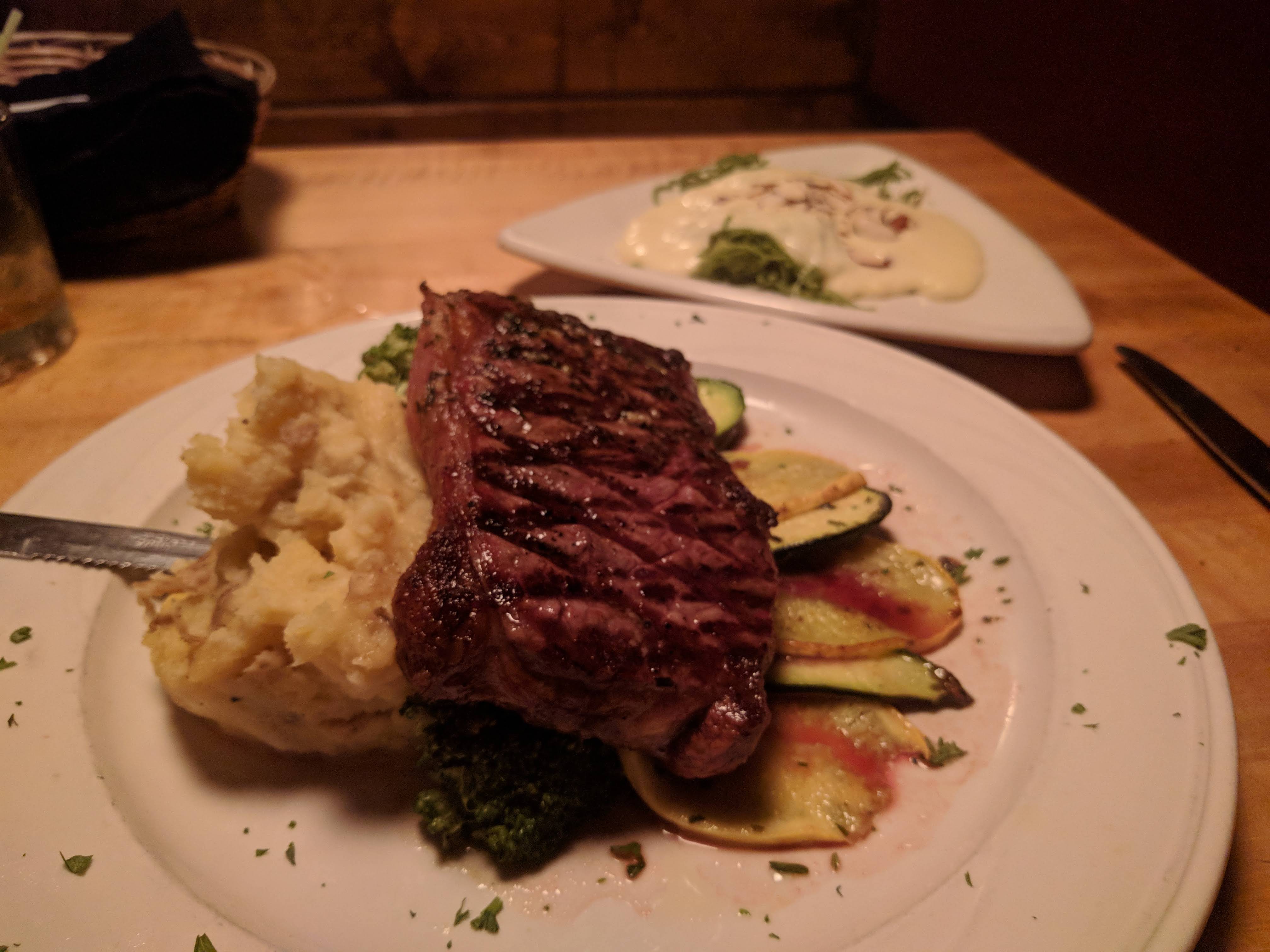
Beefsteak
9 miles (194 total)
The Push
A cold front is coming in. The clouds and cooler temperature are welcome, but the sporatic winds are not. Today I start my push back to Bozeman, which will be a bit more difficult than the arrival trip. Bozeman is about 1000 ft higher than Helena, which means a net gain in elevation. My goal for today is to get to Copper City and hopefully have enough water to last me through the night. There's no reliable source up there.
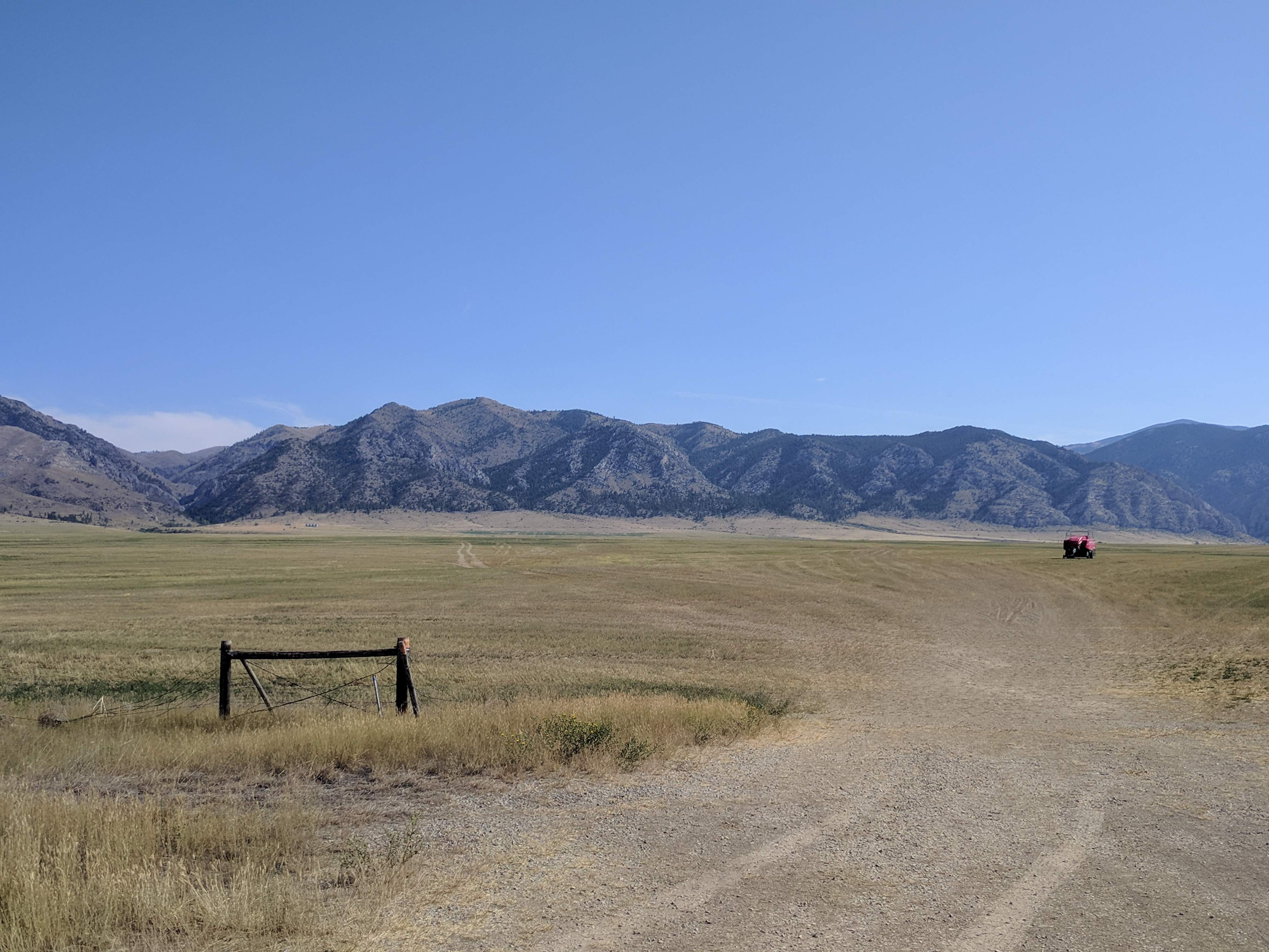
Taking the northern route around the reservoir would add an additional twenty miles and 2000 ft elevation on top of the already seventy mile ride. I opt for the easier route on Highway 287, thirty miles on a generous shoulder. Such a large shoulder, in fact, that I felt safer on this part of the highway than I do most of the time riding around town. Even with the plus sized tires I was able to maintain a fourteen mile per hour average until I hit Townsend, where I stopped for an early lunch.
I planned on stopping at Full Belli Deli for lunch this Friday anyway, so I didn't have anything more than a Clif bar for breakfast. We always pass the Deli when driving up north, but have never had the chance to stop. I've always wanted to for no good reason other than their intriguing sign. But, let me tell you, this was one of the best sandwiches I have had in the State! Give Full Belli a try next time you're in Townsend, you won't be disappointed.
The weird thing about the Townsend area is that it appears to have its own little micro climate. There were some light showers as I was leaving Helena, but by the time I was within ten miles of Townsend the sky was nearly cloudless. It was beginning to get rather warm again, which made me worry about the night at Copper City. So, before pushing off onto River Road I decide to stop at the gas station for a couple extra bottles of water.
River Road was the original route I had planned when going to Helena, until Tim talked me into Old Woman Grave Road. River Road is a bit more mild with a few rolling hills, and is better maintained. Smooth, with no washboards in sight, this would be a nice road for a day ride on a gravel bike. It ends up not far from the roads I came in on just east of Radersburg.
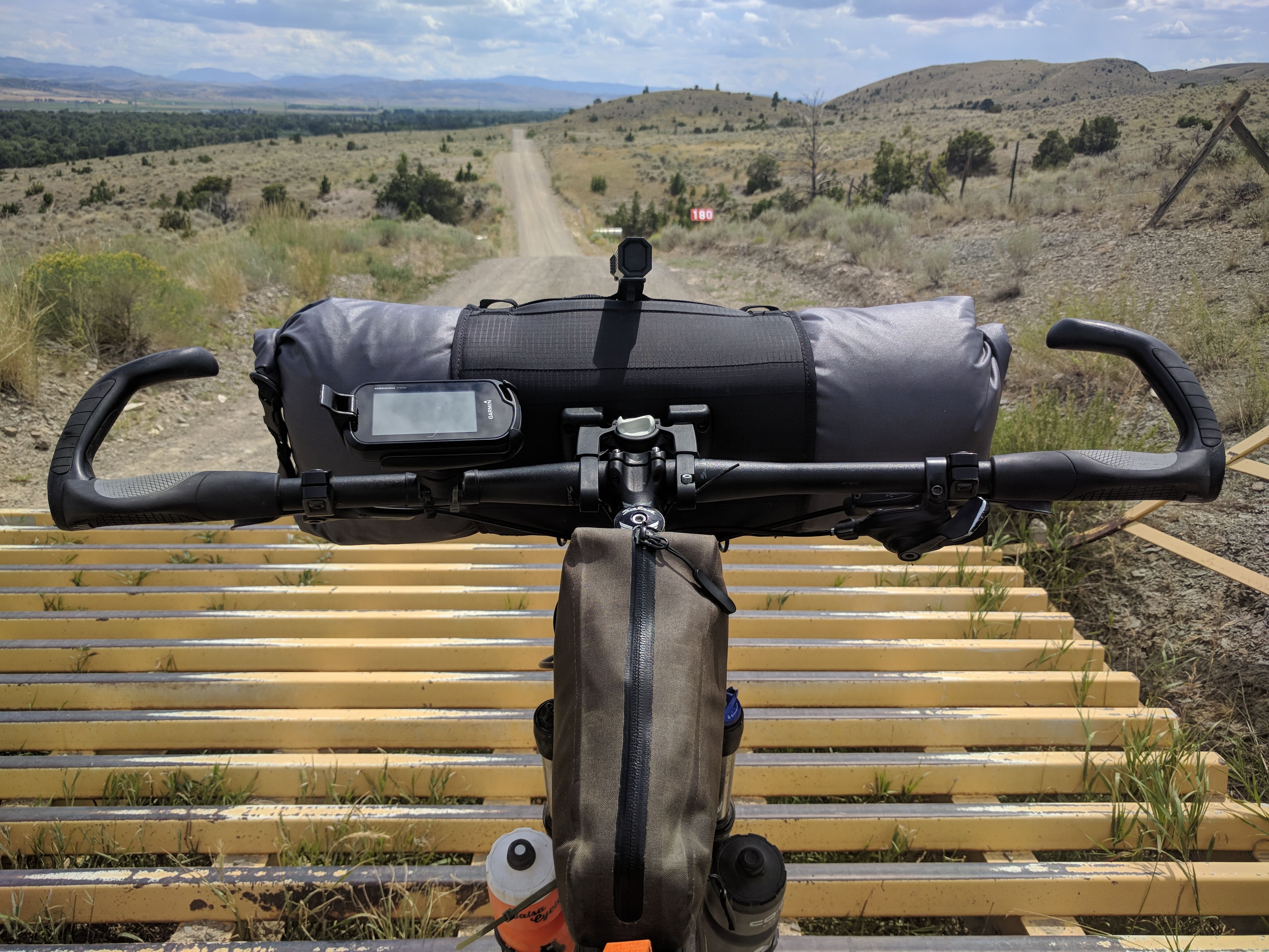
Rollercoaster
How'd I get to Pennsylvania?
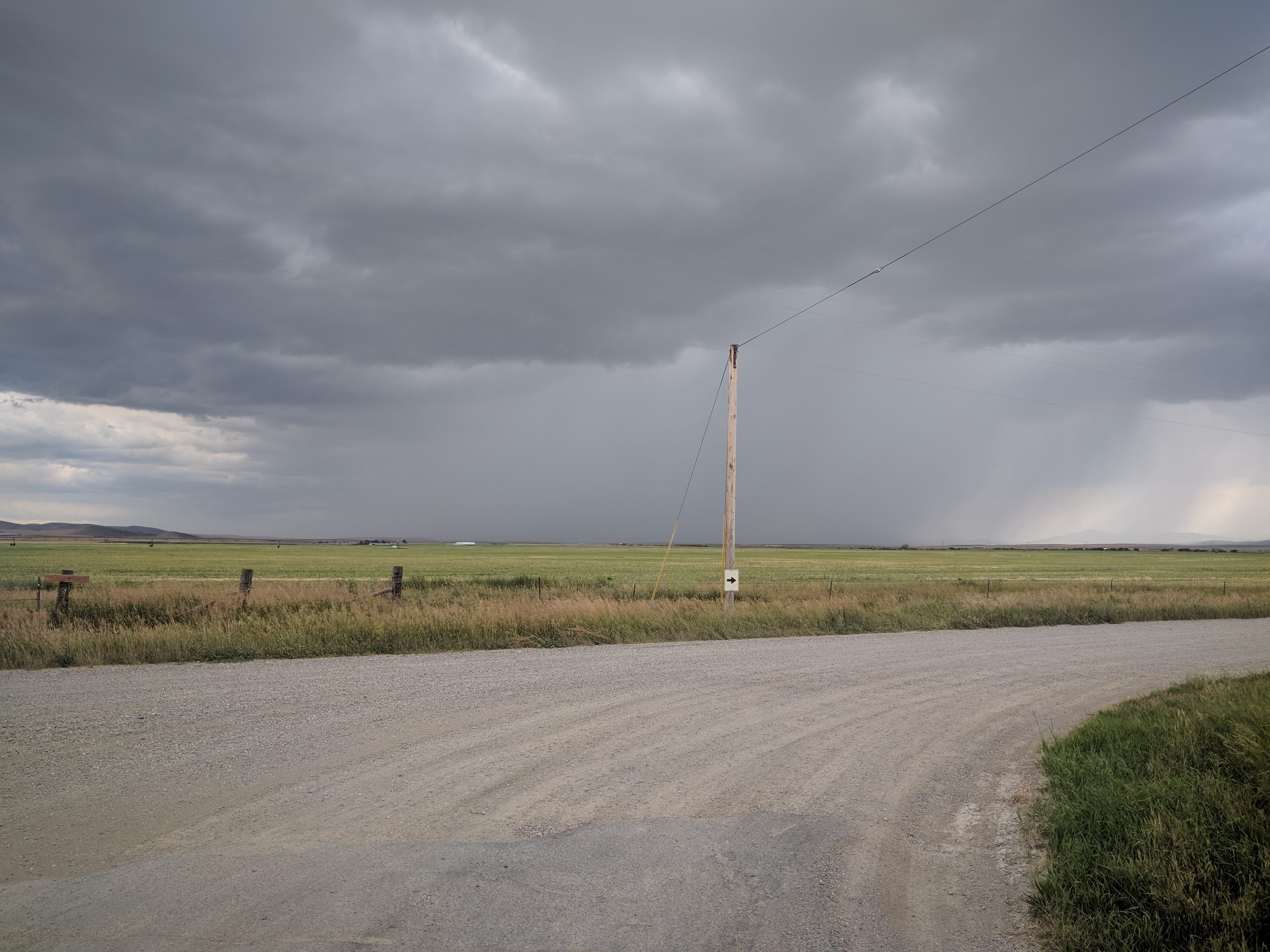
By this time I can see clouds gathering in the south and west. They look menacing. By the time I get halfway to Copper City I can see what looks to be hail closing in at an incredible rate, along with punishing lightning. I can take a little rain, I have the gear. But, I don't want to risk hail and lightning. I pull my bike into the closest farm and notice a light on in the shop.
"I hate to bother you, but do you mind if I wait out this storm in here?"
"No problem, you can take a seat over there."
A couple of younger guys mixing concrete, making what appeared to be culverts. These were the only words we spoke besides a thank you after the storm subsided. I think they were a bit perplexed with my appearance out in the middle of nowhere. Fortunately for these gentlemen there was no hail. My guess is the surrounding bounty of corn and wheat almost ready for harvest belonged to their family.
The approaching storm.
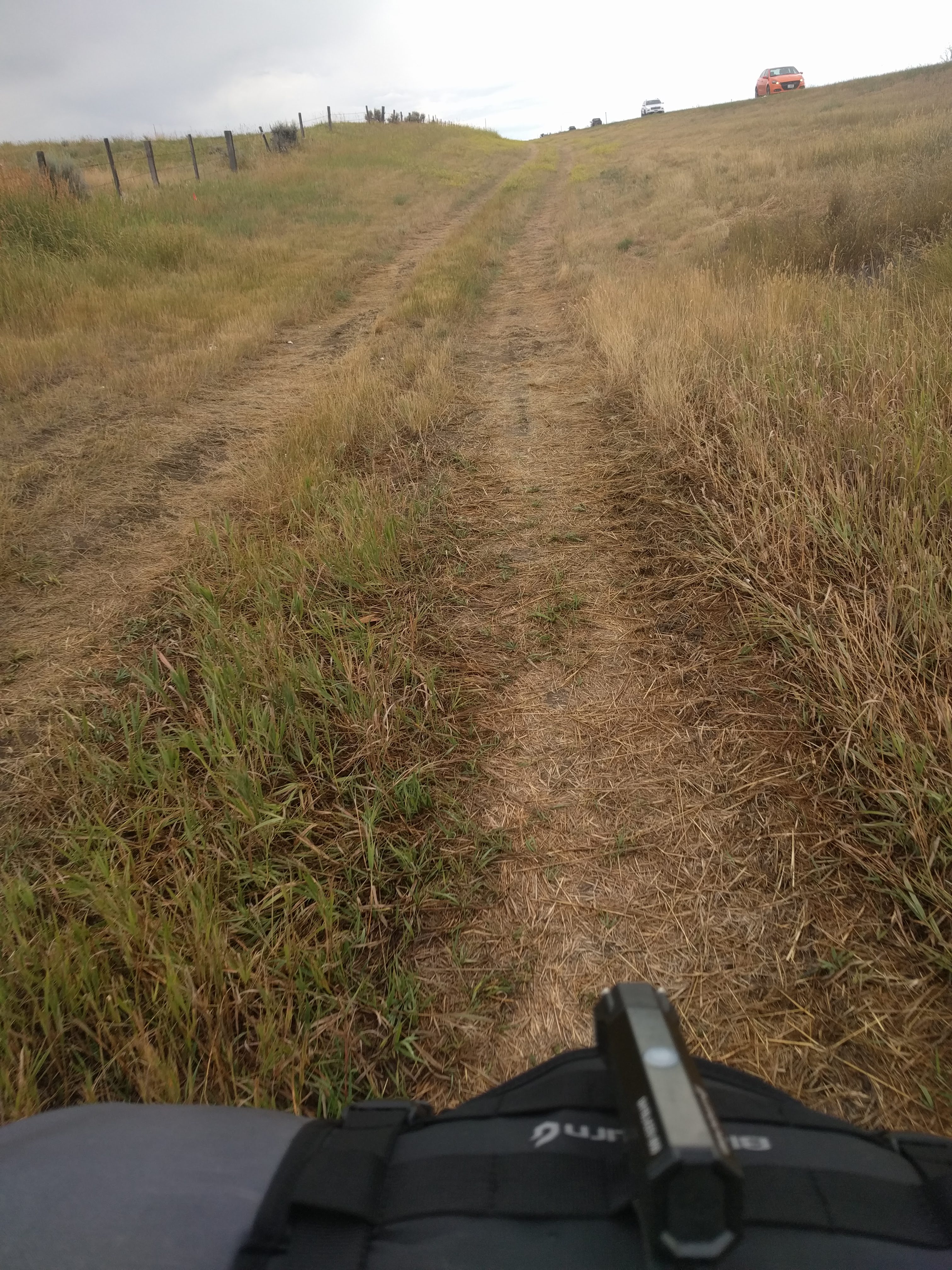
I shove off for the remaining fifteen miles of the day, covered in rain gear. It doesn't appear these storms are going to let up any time soon. To not risk trespassing again I follow the roads further east, closer to 287. Unfortunately, this puts me onto the highway a few miles north of Copper City, a section of the road with no shoulder and lower visibility from the passing rain. Luckily I'm on a mountain bike, so I hop into borrow ditch and ride the grass until I reach the turnoff at the top of the hill.
I probably ran over 32 snakes.
By this time it's still mid-afternoon. Rains are occasional and the dirt has begun to gumbo. I really don't want to be dealing with wet gear in the morning, nor do I want to risk being on the hill during a lightning storm that night. I've come seventy miles today and still feel great. What's another fourty more? I'll need to refuel.
The Land of Magic is right down the hill in Logan, an easy ride in for a small burger and fries. Perfect fuel for what I knew was going to be a painful end to the day. See, I've done this ride before. Almost exactly four years ago I had completed the Three Rivers Century ride, the return trip from Three Forks was nearly identical to what I'll be doing this evening. It's a grind. Bozeman is practically in sight for the entire thirty miles, but that's because it's entirely uphill. Wind in my face (it always is, isn't it?), this was hard enough on a road bike much less a fully-loaded mountain bike. I pass Manhattan, Belgrade, then finally pull into Bozeman just as this side of the world begins to turn dark.
At nearly 110 miles, the longest ride of my life (so far) is now behind me. Not only was this eight miles longer than my previous personal record, but it was on a mountain bike with nearly fifty extra pounds of gear, and partially on gravel. It only took a little over three hours longer.
It may not be until revolution 40, but I'll get to that Great Divide.
109 miles (303 total)
Stop